-
>
鲍勃·迪伦诗歌集:1961-2012:典藏版
-
>
双城记-英文版
-
>
四级词汇词根+联想记忆法:乱序版
-
>
The secret garden
-
>
哈克贝利.费恩历险记/床头灯英语.2000词读物(英汉对照)
-
>
10000德语分类词汇联想记忆
-
>
英语词汇全书
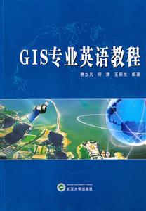
GIS专业英语教程 版权信息
- ISBN:9787307079618
- 条形码:9787307079618 ; 978-7-307-07961-8
- 装帧:暂无
- 册数:暂无
- 重量:暂无
- 所属分类:>>
GIS专业英语教程 内容简介
本教材主要介绍地理信息系统(gis)领域相关基础知识及其应用。全书共6个部分,27课。内容涉及gis的基础慨念、gis的数学基础、gis的数据结构和数据库、空间数据采集、空间分析、gis的应用与新发展等各个方面。
全书以地理信息系统领域的*新英语时文和原版教材为基础,其内容选材以系统性与广博性为原则,配以适当的中文解释和课后习题,以提高读者阅读与理解地理信息系统英语文献资料的能力。出于培养读者理解英文原文的能力,部分课文没有附带相应译文。本书既可作为高等院校的gis专业英语教材及相关专业的专业英语教材,也可作为相关专业的工程技术人员提高gis专业英语水平的读物。
GIS专业英语教程 目录
lesson 1 what is gis
new words
exercises
lesson 2 what kinds of functions does a gis have?
new words
exercises
lesson 8 origins and applications of gis
new words
exercises
part ⅱ the basic mathematical concept of gis
lesson 4 what are map projections?
new words
exercises
lesson 5 classification of map projections and their applications
GIS专业英语教程 节选
《GIS专业英语教程》主要介绍地理信息系统(GIS)领域相关基础知识及其应用。全书共6个部分,27课。内容涉及GIS的基础概念、GIS的数学基础、GIS的数据结构和数据库、空间数据采集、空间分析,GIS的应用与新发展等各个方面。全书以地理信息系统领域的*新英语时文和原版教材为基础,其内容选材以系统性与广博性为原则,配以适当的中文解释和课后习题。以提高读者阅读与理解地理信息系统英语文献资料的能力。出于培养读者理解英文原文的能力,部分课文没有附带相应译文。《GIS专业英语教程》既可作为高等院校的GIS专业英语教材及相关专业的专业英语教材,也可作为相关专业的工程技术人员提高GIS专业英语水平的读物。
GIS专业英语教程 相关资料
插图:The need to place information in a geographical text pervades many aspects ofhuman activity. In public and commercial organizations, many of these activities areconnected with the recording and planning of the human-made environment, withmonitoring and managing the natural environment, with transport and navigation, andwith understanding social structures. It is an inevitable consequence of the revolution ininformation technology that we should attempt to build computing systems to handle thisgeographical information. The results of these technological efforts are reflected in thefields of geographical information systems (GIS) and computer cartography which arethe subject of this book.When compared with the development of computing systems for maintainingcommercial and financial information, progress in the field of geographical informationsystems has been remarkably slow. One of the earliest clearly identifiable geographicalinformation systems is the Canada Geographic Information System ( CGIS), which wasdeveloped for planning purposes. Although the system can be regarded as having laid thefoundations, in the mid 1960s, for many subsequent GIS, it was not in fact followed by aproliferation of similar systems. It was only in the late 1980s that we saw theintroduction of proprietary GIS which could claim to meet a significant proportion of thedata-handling requirements of organisations concerned with geographical information.Examples of organizations in which these requirements arose include environmentalmapping agencies, local and regional government administrations, marketingcompanies, mineral exploration companies, the military, and utility companiessupplying water, electricity, gas and telecommunications.
- >
大红狗在马戏团-大红狗克里弗-助人
大红狗在马戏团-大红狗克里弗-助人
¥3.3¥10.0 - >
伊索寓言-世界文学名著典藏-全译本
伊索寓言-世界文学名著典藏-全译本
¥6.1¥19.0 - >
诗经-先民的歌唱
诗经-先民的歌唱
¥15.1¥39.8 - >
李白与唐代文化
李白与唐代文化
¥9.9¥29.8 - >
罗庸西南联大授课录
罗庸西南联大授课录
¥13.8¥32.0 - >
莉莉和章鱼
莉莉和章鱼
¥18.1¥42.0 - >
随园食单
随园食单
¥20.6¥48.0 - >
名家带你读鲁迅:朝花夕拾
名家带你读鲁迅:朝花夕拾
¥10.5¥21.0
-
汉译英基础教程:外语院校翻译系列教材
¥8.6¥27 -
财政学专业英语
¥9.5¥28 -
2022图书×抽奖盲袋
¥9.9¥25 -
2023读书月阅读盲盒——天黑,闭眼,刀谁?
¥42.3¥158 -
2022读者节纪念徽章-三星会员专属
¥45¥45.6


